
Contact

General introduction

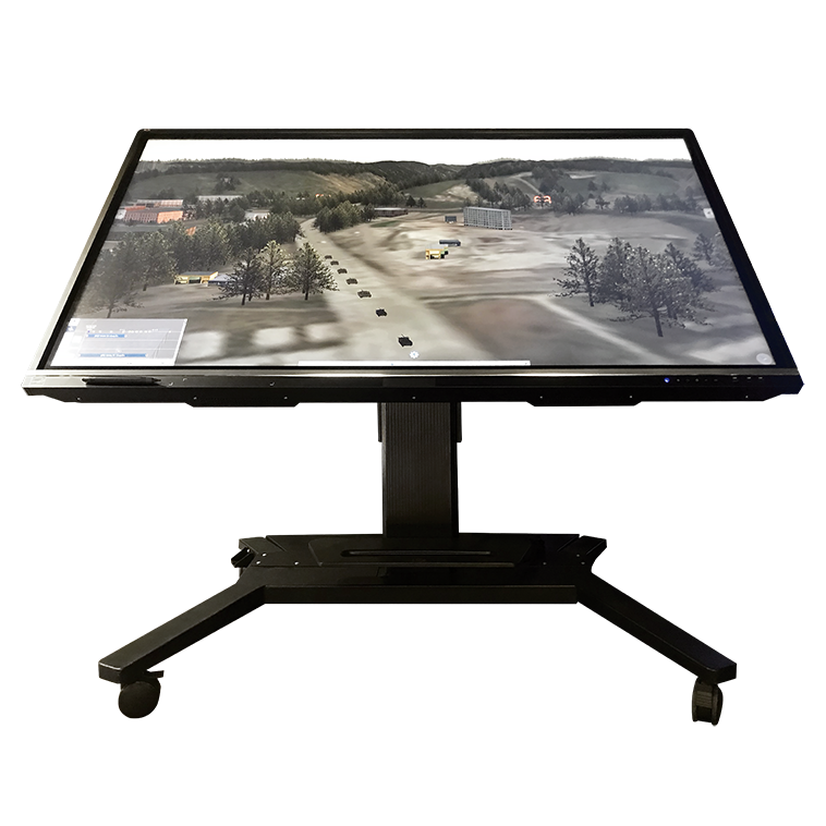
VSTS is a framework for devising strategic plans, and terrain analysis on 2D/3D digital maps, replacing traditional paper maps and physical models. Tailored to accommodate tactical, operational, and strategic levels of combat and various battlefield environments, including air, sea, and land, the system is well-suited for use in routine command center operations as well as in exercises and training operations.

Feature

  • Replacing traditional physical terrain sand tables and paper maps with virtual 2D/3D sand tables, reducing costs and allowing easy modification.
  • Comprehensive solution including area reconnaissance, combat plans drafting, reports presentation and operational intent visualization.
  • Synchronization of combat plans between 2D and 3D maps as well as between multiple subsystems.
  • Supporting construction of illustrative scenarios and 3D simulations depicting the battlefield developments.
  • End-to-end data encryption.

Specification

Geospatial Mapping

Allows integration across 6 map layers with the following map scales: 1/10,000, 1/25,000, 1/50,000, 1/100,000, 1/250,000, 1/500,000, 1/1,000,000; with elevation data resolution of up to 5 meters and satellite imagery with a resolution of up to 0.6 meters per pixel.

Tactical Symbol Management

Manages and integrates unlimited number of military symbols.

Real-time Simulation

Simulates military equipment with a calculation frequency exceeding 30Hz and a rendering speed of 30 frames per second.

Multi-user Collaboration

Allows up to 5 users to simultaneously develop combat plans.

Large-scale Operations

Simulates operations involving over 200 military equipment and combat vehicles in the same scenario with a calculation frequency exceeding 30Hz and a rendering speed of over 30 frames per second.

Comprehensive Reporting

Presentation of reports allows for over 200 slides/reports.